
Cassidy Arch, Cohab Canyon and Goblin Valley State Park

[Capitol Reef National Park and Hankville, UT – Mar 26, 2022]
For my second day in the park, I rearranged my hikes a bit based on info I got from the ranger at the visitor center the day before. A big part of my schedule hinged on getting to Gifford Homestead around 9 am when they opened. I intended to have their pies for breakfast! I also wanted to get their cinnamon roll, which was sold out by the time I got there the day before. In order to do this, I was planning on doing the Cohab Canyon hike at sunrise because its trailhead is right by the homestead. But the ranger told me that Cassidy Arch, which I planned on doing later, is very popular and I should do that first. It meant getting to Gifford homestead a bit later than 9 am but I was willing to risk it. Crowds on a popular hike are just a joy kill!
So, with just coffee and some snack food in my belly, I headed out for Cassidy Arch. The trailhead is off a dirt road in the southern part of the scenic drive, so it took about 25 minutes to get there. Since I wasn’t getting breakfast at the hotel, I left earlier than the day before and I got treated to this awesome sunrise on the way.

The Cassidy Arch trail is only 3.1 miles with 600ft of elevation. After a flat start into Grand Wash canyon (another hike that begins here), the trail quickly gains almost the entire 600ft of elevation in the next half mile.


From there, you skirt the plateau with views of the canyon and the dirt road that leads to the trailhead. This part of the trail is a bit exposed. It’s not too long until you go further into the mesa and the drop-offs disappear.


It wasn’t too long and I could see the arch in the distance. Can you spot it in the photo below?

Soon, I reached the turn-off for Cassidy Arch. The trail was now over the giant rocks so I was back to watching out for the cairns to mark the way. When I reached what I thought was the arch based on my Alltrails tracking, I didn’t see anything around me. Confused, I looked to my left and the arch was right there! Interesting fact – the arch is named after Butch Cassidy, the infamous outlaw of the late 1800s. Apparently, he used to hide out in the canyon!
I continued on to the top of the arch. It was actually pretty wide – about 16 ft. It still made me nervous. The steep drop off on one side looked quite precarious! I was kind of sad there was nobody around to take my picture standing on the arch, but I think I took some decent selfies.


As I headed back, I encountered more and more people on the trail. I got back to the trailhead around 9 am and it was down right busy.
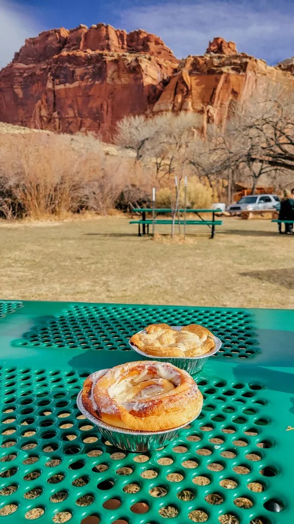
I made it to Gifford Homestead in time to grab some cinnamon rolls and more pies! This made for a delicious breakfast outside. After my hike on an almost empty stomach, this was much needed!


Next, I headed to the Cohab Canyon trail. The trailhead was just up the road from the homestead, across from the barn. The trail begins with some steep switchbacks. The climbing was not easy, especially on a full stomach, but it was fairly short and I enjoyed the iconic view of the barn, the homestead and the cliffs behind them from up there.


Soon, I turned into Cohab Canyon. It was bigger than I expected.


As I made my way through, I noticed lots of nooks and crannies. One in particular looked really intriguing – it was so tall and narrow! I walked into it and was amazed how much cooler the air there was. The tall walls around this tiny space protected it from the sun’s rays, keeping it noticeably cooler.

I arrived at a relatively wide and flat area with interesting rock formations that reminded me of goblins. I was planning on driving to Goblin Valley State Park later, so this gave me an idea of the formations I’d expect to see there.


I soon arrived at a trail junction. If I’d kept going straight, I would have ended up at the trailhead for Hickman Bridge from yesterday. I could turn right onto the Frying Pan trail, which, after about 3 miles, would have lead me to the Cassidy Arch turn-off I mentioned earlier. I knew that these trails connected based on my research before the trip. However, this is ideally done as a point-to-point hike, which requires arranging a hiker shuttle ahead of time. I didn’t want to make firm enough plans for that, so I left this option for another visit.
At this point, I turned back and out of the canyon the way I came. The whole trail is about 3 miles if you go all the way to Hickman Bridge and back. I only clocked in 2 since I turned around early.

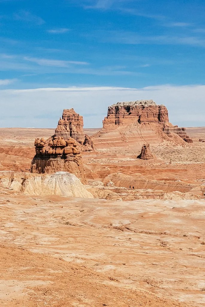
Next on my list was Goblin Valley State Park, about an hour away. The park features thousands of hoodoos, known locally as goblins, similar to the ones you see at Bryce Canyon national park. The distinct shapes of these rocks result from an erosion-resistant layer of rock atop relatively softer sandstone.
When I got to Goblin Valley, it was already early afternoon and there were probably 10 or so cars already waiting to go in. Since parking inside the park is limited, rangers had instituted a one out – one in policy, so there was no telling how long it would have taken to get in. The ranger recommended I check out Little Wild Horse Canyon nearby first. Since that was already on my list, that’s what I did!

There are two canyons here, actually – Bell Canyon and Little Wild Horse. They form a loop that begins about a half-mile into the wash at the trailhead. The entire loop is about 8 miles but I had no intention of doing the whole thing. I did not have the time or energy, plus with temps in the upper 70s and the sun right above, I was getting hot. I chose to go into Little Wild Horse and went up about a half mile before I deemed it a little boring compared to what I had just seen at Capitol Reef and turned around. The trail was also very busy, so that made the narrower spots a little more involved. As I was heading back to my car, a huge group of 20+ people headed into the canyon. I was glad I was out of there!


Back at Goblin Valley, the line to enter had completely dissipated, to my pleasant surprise. I parked and made my way to the sea of mushroom-capped goblins in the valley. There were no marked trails – people just explored on their own amongst the hoodoos. The harsh mid-afternoon light wasn’t the best for photos, but I enjoyed meandering around. The temperature had risen to the upper 70s by now and I was ready to get back to my hotel for some rest and relaxation.


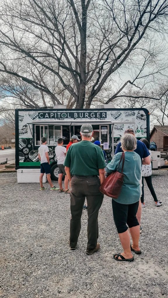
For dinner, I decided to go back to Capitol Burger. This time, I indulged in their Mac’n’Cheeseburger with fries. WIth all the hiking I’d been doing, I figured I deserved a treat!

In the evening, I had planned on doing a star-gazing experience with Sleeping Rainbow Adventures. Unfortunately, it didn’t happen due to cloudy weather and not enough people signing up. Instead, I decided to take the scenic highway 12 between Torrey and Boulder. This was the only part of the drive I hadn’t done. In 2017, I did the portion from its starting point near Zion to Boulder as part of my Southwest Utah trip.
The first overlook had great views of the entire park. This vantage point really helped me see Capitol Reef’s defining geologic feature – the Waterpocket Fold. This wrinkle in the earth’s surface extends for nearly 100 miles and creates the rugged cliffs, canyons, natural bridges, arches and other formations that define this part of Utah. It’s a classic monocline: a steep fold on one side of otherwise horizontal geological layers, about 7,000 feet higher in the west than on the east.


At the next overlook, I startled some deer.


After almost an hour, I reached the town of Boulder. This remote place is home to less than 200 people. It is the last town in the continental US to receive its mail by mules. When Highway 12 between Escalante and Boulder was paved in the 1940s, the town finally started receiving its mail by automobile. Still, Boulder remained very isolated because the portion of Highway 12 connecting it to Torrey remained unpaved until 1985. The unpaved road often remained closed for 6 months out of the year due to winder conditions over Boulder mountain.


It was fun seeing Boulder again after all those years and finally completing Highway 12! I caught the best part of golden hour at the overlooks and got back to my hotel just as it was getting dark. I was so tired from all the stuff I had done that day but I still managed to pop into the hot tub for a quick dip.


Pingback: 3 Perfect Days in Capitol Reef National Park - Balabanova All Over